Hiking doesn’t get any better than this. A well-constructed approach up a beautiful creek, a brisk climb to a ridge, with unlimited views and a lot of room to roam up top.
Chalice Ridge
Synopsis
Hike
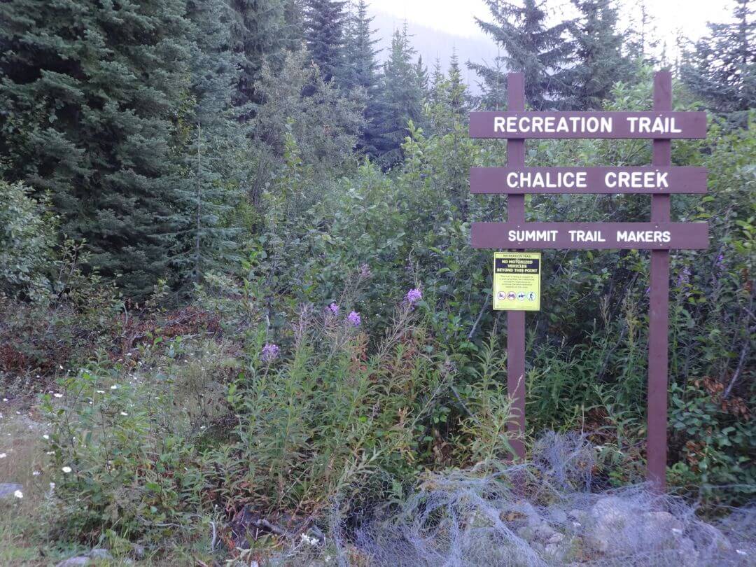
Trailhead
On the south side of the clearing is a Forestry Rec sign. The trail starts to the left of the sign.
Trail
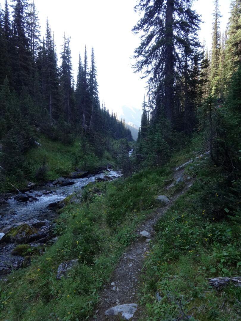
The trail heads south along an old skid road for 200 metres until it reaches Chalice Creek. The trail then climbs up the north (ie the near side) of the creek. It used to cross the creek here; it no longer does; don’t worry when you see half the footbridge lying in the creek.
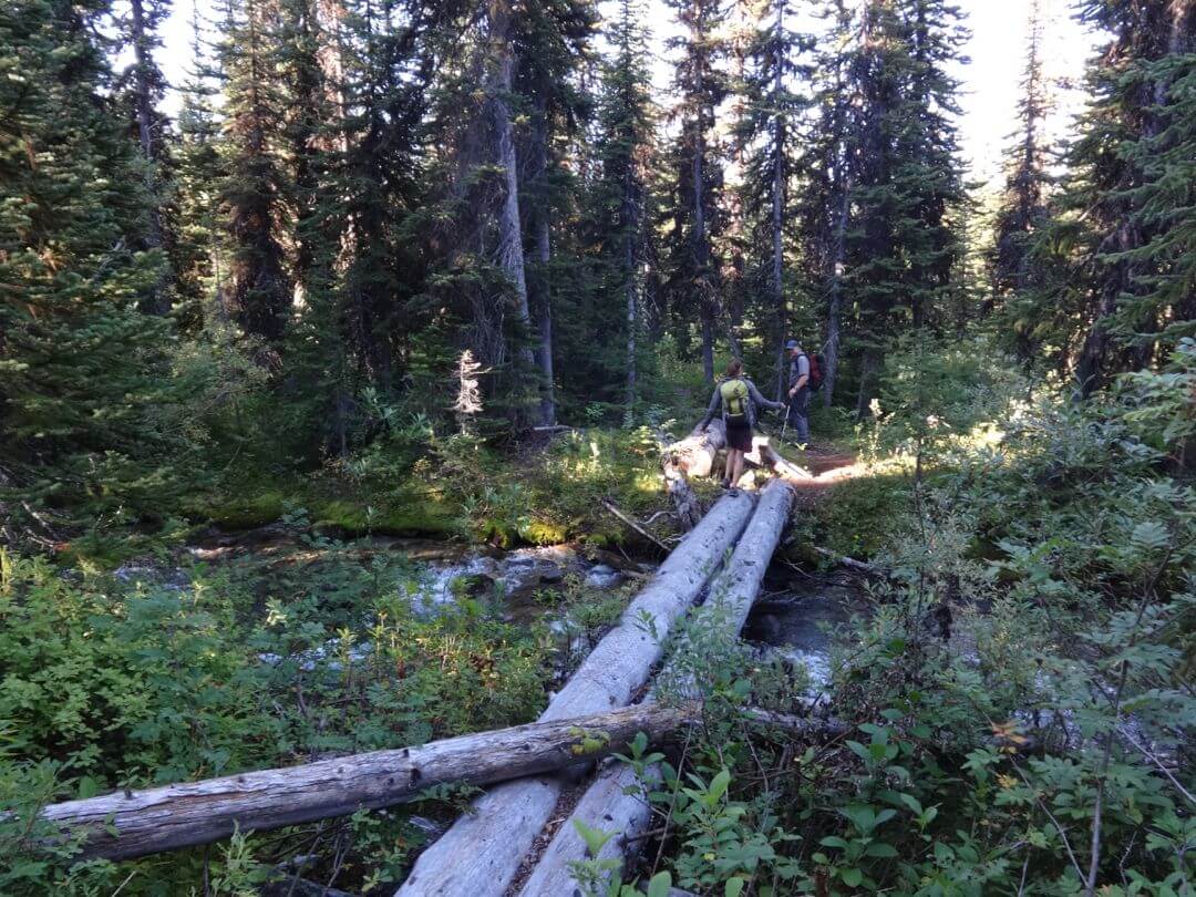
The trail gains 100 metres on the north side of the creek. Stop and check out the creek itself in this section; it really is impressive. After about 700 metres, the trail makes an abrupt right turn and crosses the creek on two spruce logs. Fifty metres after the crossing, you meet up with the old trail.
The next section of the trail is easy, although parts may be muddy. Follow this section up the valley for 1.3 km.
Eventually, the trail turns right, moves up into the cutblock for about 25 metres, and then turns left and enters the forest. Expect both rock and mud in this section. At one point, you skirt some large timber which was probably whacked by an avalanche off the opposite slope years ago. Then the creek, and the trail, turns south and continues through forest.
When the trail again starts to follow close to the creek, keep an eye open for the trail to split (this occurs at approximately 3.5 km from the parking area). This split will happen before reaching the marshy area in the lower end of the bowl of Chalice Creek. You want to take the left fork which drops down 5m to the creek. (The right fork continues only a short way before the trail starts to disappear; if you reach the wide open marshy meadow you’ve gone to far).
As stated, take the left fork (at approx. 3.5 km) and drop down to the creek to cross on some logs. Pick up the trail on the far side.
The trail enters the forest and switchbacks up to the ridge. There is a bit of windfall on this section, but otherwise it is in excellent shape. You will gain 300 metres in the next little while, until you break into the subalpine and gain the low end of the ridge. It’s a workout.
The view of the Bugaboos from the flat area up top is overwhelming. Take a moment and note where the trail emerges, so you can find it when you head down. There are several bits of flagging tape there.
After catching your breath, you need to decide which direction to explore. Options:
i) The recommended option is to head south, which involves hiking up the grassy slope located about 45 degrees to your right from where you entered into the meadow. This is the easiest route up. It is possible to wander south along the ridge for more than a kilometre, and there are too many mountain ranges in view to name. There are actually several ridges here, so you can head south on one and return on the other, if you want. You will reach a col above the south end of Septet Creek. It is possible to continue south along the ridge to a minor peak.
ii) Another option is to head straight across the meadow to a cairn and a well-defined trail. This will lead you over a number of rolls before reaching a rib above a small lake, where you get a great view of the Septet Range.
iii) A third option is to head north (ie 45 degrees to your left from where you entered into the meadow). You can see where it is possible to gain the Bugaboo-Septet Ridge to the north.
Cautions
As with all ridgewalks, keep an eye on the weather.
Trail Map
Download & Print
Access
Note: although this is not actually that far in distance from Golden, it will take you at least 2 hours to drive.
From the lights in Golden, drive south on Highway 95.
After 63.0 km at the Hamlet of Spillimacheen turn right on the Westside Road and cross the Columbia River valley.
Set your Odometer to “0” here.
2.3 km turn left on the Westside Road (do not take the Giant Mine Road).
7 km take the right hand fork of the Y junction.
9.5 km you reach a four way intersection where you will set your odometer to “0” (again).
0 km Turn right onto Bugaboo FSR
11.5 km, stay right. Do not take the left fork to Cartwright Lake.36.5 km bear left and do not enter Bugaboo Provincial Park.
37.4 km turn left and cross Bugaboo Creek on a bridge.
-Take the right hand road at the Y immediately after this bridge.
– Drive for 1.0 km to where the road widens just enough to park a vehicle and there is a sign saying Chalice Creek. At this point, if you have a high clearance vehicle, continue up the road. If you have a low clearance vehicle or value your paint job, park off the road to the right and out of the way of other vehicles. There is space there for only for a couple of cars.
– Drive or walk the next 1.9 km. It is getting very overgrown and has some moderate water bars. At 1.9 km, you reach an opening in the bush with room for a few vehicles. Park so others can turn around! There is a stash of chicken wire here to wrap your car if you are overnighting it. See below for an explanation.
Alternative approach:
From the lights in Golden, drive 75.8 km south on Highway 95 to Brisco and turn right on Brisco Road.
Set your odometer to “0”
7 km pass a steep road leading up on your left.
8.5 km turn left onto Westside Rd
11.1 km you will reach the four way intersection described above. Set your odometer to “0” (again). Turn right onto Bugaboo FSR and follow the directions above.
Note
Visitors never believe this, but it’s true. The local porcupines will eat the rubber parts of your car to get the road salt. This could very well make your car undriveable. The solution? Wrap your car in chicken wire, and anchor it with rocks and pieces of wood. (For day trippers, this precaution might not be necessary.)
Photos