The easiest hike on this site. It is included only to differentiate it from Lower Bugaboo Falls, a much more interesting hike.
Bugaboo Falls – Upper
Synopsis
Hike
Trailhead
Just to the east of where you are parked is an outhouse. The trail begins on the right side of the outhouse.
Trail
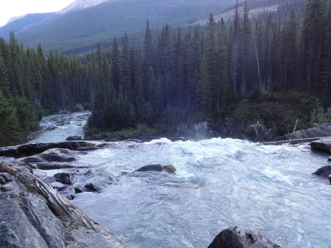
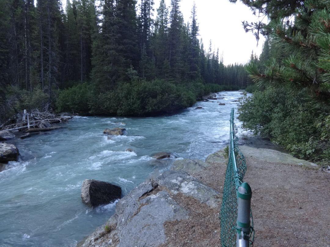
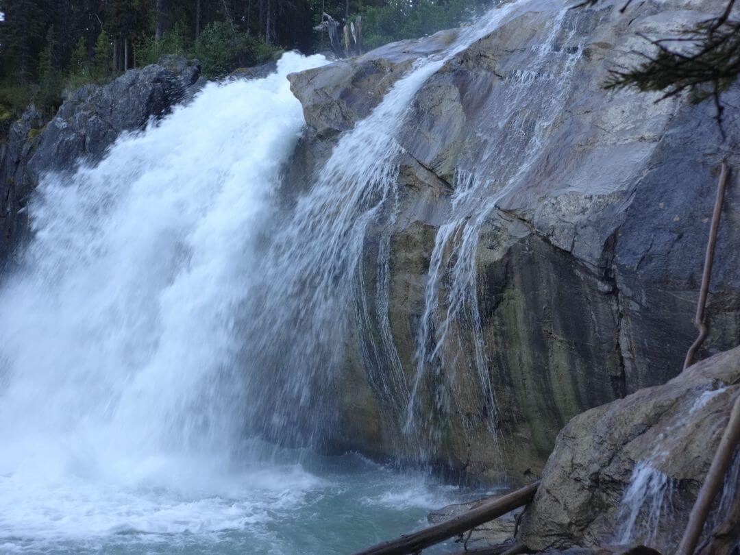
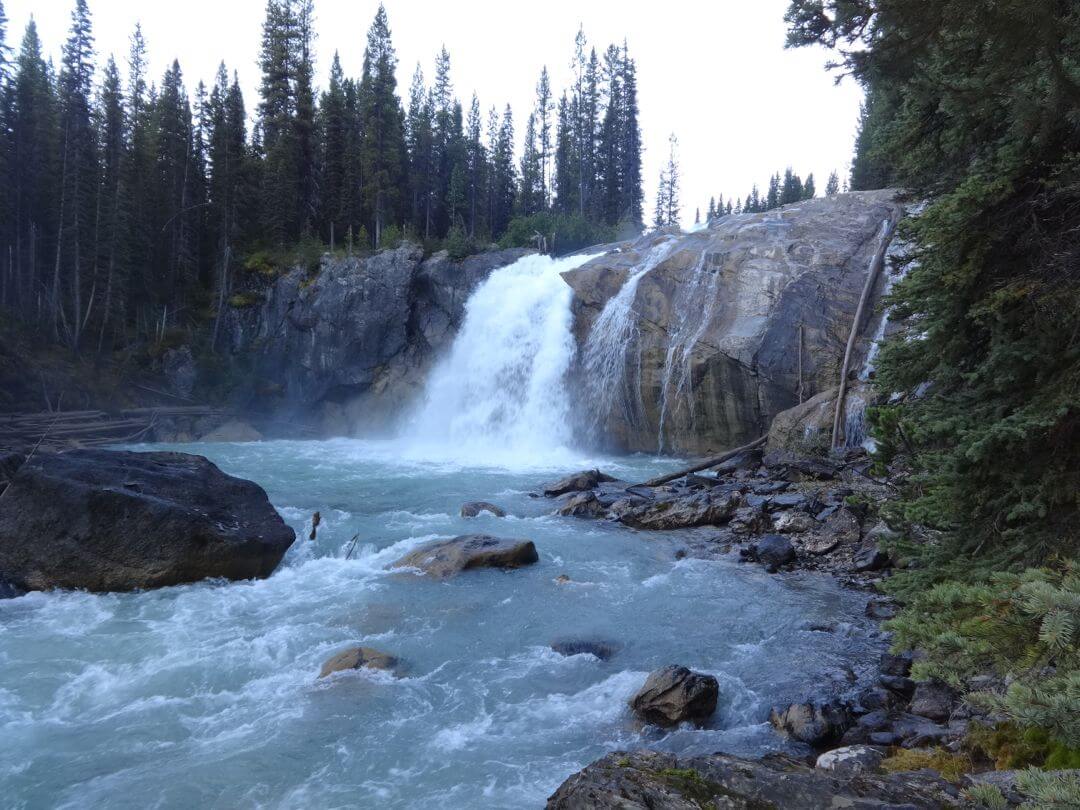
The trail descends to the base of the falls. There are several spots from which you can observe the falls. Part of the trail is protected by fences.
Trail Map
Download & Print
Access
From the lights in Golden, drive south on Highway 95
63.0 km at the Hamlet of Spillimacheen turn right on the Westside Road and cross the Columbia River valley.
Set your Odometer to “0” here.
2.3 km turn left on the Westside Road (do not take the Giant Mine Road).
7 km take the right hand fork of the Y junction.
9.5 km you reach a four way intersection where you will set your odometer to “0” (again). [read more]
0 km Turn right onto Bugaboo FSR
11.5 km, stay right. Do not take the left fork to Cartwright Lake.
33.5 km you will find the Forestry Rec Site for (Upper) Bugaboo Falls. Park off to the side of the road.
Alternative approach:
From the lights in Golden, drive 75.8 km south on Highway 95 to Brisco and turn right on Brisco Road.
Set your odometer to “0”
7 km pass a steep road leading up on your left.
8.5 km turn left onto Westside Rd
11.1 km you will reach the four way intersection described above. Set your odometer to “0” (again). Turn right onto Bugaboo FSR and follow the directions above.
Photos