An easy stroll to the top of the falls. Often used by campers for that daily jog. Suitable for small children. Don’t expect to be alone.
Wapta Falls
Synopsis
Hike
Trailhead
Gravel path leaves from south edge of parking area. It is marked with a National parks trail signpost.
Trail
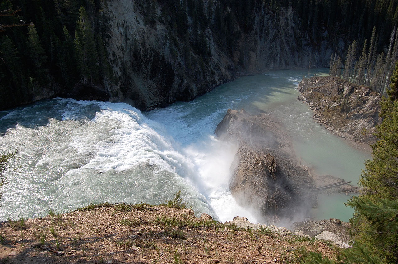
An easy stroll along a level path for 1.9 kilometres to the top of the falls. From here, a trail heads back into the forest for a bit before heading to the river and the bottom of the falls. You lose about 60 metres in elevation on the way down, and regain it coming back up. Worth the trip. [read more]
If the river level is low enough, you can get out to the islands in the middle of the river without getting your feet wet. Of course, once you are there you and everything you are carrying will get absolutely soaked by the spray. Good view, though, and very refreshing on a hot day.
Random notes from the Wapta Falls trail: Hiking is unlike Twitter in that it allows time to reflect. Walking the trail on a hot spring day, with absolutely no one else in sight, it occurred to me that I had never seen such a fuel load as exists near the south end of this hike, where the mountain pine beetle has killed most of the forest. A bit later, I realized the obvious: of course I hadn’t. If it weren’t for the fact the trail crew cuts a path through all this dead pine windfall, I never could have gotten here. The forest in impenetrable. One hot summer there will be a lightning strike and this whole area will burn, which is what nature intended. The fire won’t affect the falls, and will clean out all that deadwood. So that’s good.
It also occurred to me that the likelihood of a bear encounter is greatly reduced, because, like us, the bear would have a very difficult time getting there, except by the trail. The flip side of this, of course, is that if a bear encounter occurs, the odds of it being serious escalate, because there is no place for the bear to go other than along the trail. Heading off into the bush isn’t an option for either party.
I told you these were random thoughts. Okay, you can go back to Twitter now.
Cautions
- A National Parks permit is required.
- The usual wildlife cautions apply.
- If you do this in the off-season, you might have to walk from the highway parking area, which will add 1.8 km each way.
Trail Map
Access
From the junction of Highway 95 and Highway 1, drive east on the Trans Canada Highway for 31.8 kilometres to the Wapta Falls trail turnoff. Turn right and drive 1.8 kilometres on a gravel road to the parking area at the trailhead.
Photos